Hazards, Resilience and Climate Change

Coastal Flood Risk Reduction Course

Nicole Faghin, Coastal Management Specialist

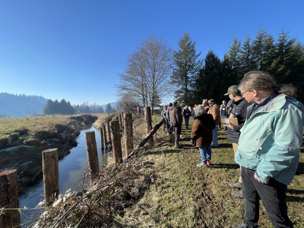
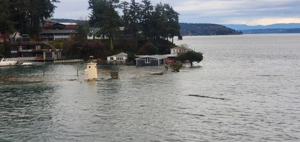
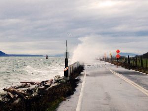
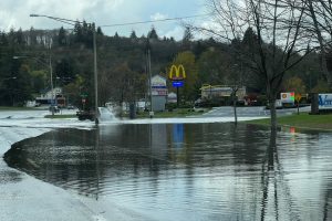
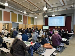
Many major disaster declarations are due in whole or in part to flooding. But communities can adopt various corrective and preventive measures to reduce flood damage. The coastal flood risk reduction course incorporates floodplain management practices, and participants learn about the traditional structural and nonstructural mitigation approaches to reduce risk, increase opportunities for prevention and increase resilience.
The coastal flood risk reduction course is offered through the National Disaster Preparedness Training Center and taught in local communities throughout Washington state. It provides an overview of the flooding risks to coastal built and natural environments, in addition to introducing capabilities (approaches and tools) that can support coastal prevention and mitigation, preparedness, response and recovery.
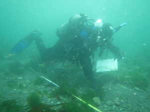
Coastal Hazards Assessments, Shoreline Assessments, and Climate Change Adaptation facilitation

Nicole Faghin, Coastal Management Specialist, Ian Miller, Coastal Hazards Specialist and Sue Blake, Water Resource Educator

In its partnerships with communities working to prepare for climate change, WSG has found that local-scale assessments result in local action and planning that improves resilience. State climate change projections suggest that Washington’s coastal communities will bear the physical and ecological brunt of rising ocean temperatures and sea level, more frequent storms, hydrologic changes to freshwater systems and other impacts.
WSG staff actively work with coastal communities to assess their vulnerabilities to climate change and develop adaptation plans that can reduce their risk over time. WSG offers courses on planning for climate change, facilitates or conducts vulnerability assessments for communities and constituents, and promotes and conducts applied research to identify climate impacts in coastal Washington.

Coastal Hazards Resilience Network

Kevin Decker, Coastal Economist

Preparing our communities for resilience along the coastline of Washington is a top priority of Washington Sea Grant. As the culminating product of the 3-year Washington Coastal Resilience Project (WCRP), WSG partnered with Washington Department of Ecology to create a new website for the Coastal Hazards Resilience Network (CHRN) that included a site-specific interactive “Risk Reduction Project Mapper.” The mapper offers users a way to learn about coastal hazards science, with the hopes that, through education and understanding, coastal disasters might be reduced.

Washington’s coastlines hold a plethora of economic, environmental, social, and cultural heritage benefits for our state and Tribal Nations. The state’s coastal areas are also heavily populated, thus making them vulnerable to natural hazards such as flooding, landslides and earthquakes. Climate change and rising sea levels will only compound the frequency and severity of these hazards, and far-sighted community planning and project design will be vital in facing these impacts effectively.

Another key product of the WCRP project was the sea level rise data visualizations created by WSG and the WCRP team, which produced updated probabilistic sea level rise projections for the entire coastline of Washington State. University of Washington Climate Impacts Group created a tool to visualize the projections, together the WCRP provided planners and jurisdictions with critical new tools for coastal resilience planning.

King Tides

Bridget Trosin, Coastal Policy Specialist

Ecosystems, infrastructure and people will be impacted by the phenomenon of climate change and rising sea levels. The King Tides Program and community events inform coastal dwellers about twice-yearly extreme tides. Citizens’ photos of king tides are posted on the website.The website helps local communities and decision makers visualize the challenges we will face as the climate changes.

More information:

New modeling tool shows impacts of sea level rise, coastal flooding to Whatcom County

February 27, 2024

Created by the United States Geological Survey (USGS) and supported by Washington Sea Grant, the Coastal Storm Modeling System (CoSMoS) will soon be available for use across Washington state

From rising seas to eroding shorelines and more frequent, intense storms, the hazards faced by coastal communities are only projected to grow. Recognizing these threats, planners and managers around Washington are assessing the vulnerability of their communities and planning for impacts – in particular, the impacts of coastal flooding due to storms, sea level rise, and river flooding. But planning for coastal flooding can be difficult when so many different, compounding factors affect where water flows and how high it gets.   

Courtesy of Washington Sea Grant. Photo by Pete Granger.

The Coastal Storm Modeling System (CoSMoS), now expanded to include Puget Sound, is one tool that can help. CoSMoS is a numerical modeling system uniquely capable of interpreting the physics of compound flooding – coastal storms, sea level rise, and river flooding – down to the local scale. As a result, planners, managers and residents can use the new system to help them understand the impacts of coastal flooding to county property, homes and businesses. Whatcom County is the first in Washington state to receive specific projections and results from the tool. And while Whatcom County results were published first, location-specific CoSMoS data will soon be available statewide.   

Puget Sound comprises 2,600 miles of coastline – home to diverse communities, important infrastructure and industry, and habitat critical for commercial fisheries, Tribal Treaty Rights and public well-being. Much of this coastline is at risk of flooding due to the combination of sea level rise, storms, tides and overflowing rivers. Yet whether it lies within a river floodplain or holds important municipal infrastructure, each piece of shoreline has unique and valuable traits that flooding can impact in different ways. CoSMoS has several key features that make it especially useful for examining potential impacts to Puget Sound. First, the system incorporates wind, atmospheric pressure, and sea surface temperature data from global climate models. It then combines these data with models of local water levels that include factors like tides and storm surge. Finally, CoSMoS incorporates a wide range of sea level rise scenarios, allowing planners to view potential flooding impacts in both the near and long term.      

“The model couples together a lot of different coastal impacts. It’s not just sea level rise data, just wave data, just storm data – it’s all of those things together, and all of those things can be factors in the flooding that people experience,” says Sydney Fishman, coastal management specialist at Washington Sea Grant. “The fact that CoSMoS can model all of these factors, that makes it especially important for our geography.”

Predicting local flooding impacts with this level of precision has many uses, especially to local planners. Whatcom County already experiences periodic flooding and storm damage, in particular on the coast and around the lower Nooksack River. The county is actively planning for future higher water levels, more intense storms, and the flooding they bring. Data such as those from the CoSMoS project help planners determine which assets – from roads to ports and parks – are most at risk, and which are most in need of protection. CoSMoS has even been combined with other information to show local socioeconomic impacts from different flooding events. With information in hand, planners can begin to determine which mitigation and adaptation strategies will work best to protect their particular communities. 

Plugging the data now available for Whatcom County into USGS’s Hazard Exposure Reporting and Analytics (HERA) web tool allows a user to define a flooding scenario and see the impacts on particular assets in the county. For example, a user can see how many miles of road would likely be flooded in a scenario of 1.6 feet of sea level rise plus a 100-year coastal storm (defined as a storm with 1% chance of occurring in any given year). The user could even specify roads by type, such as highways, surface streets, or secondary streets.

“CoSMoS has been an invaluable resource,” notes Chris Elder, Senior Watershed Planner at Whatcom County. “It provides local governments like Whatcom County with the ability to not only have a better understanding of storm surge extent and depth, but also to understand inundation and storm surge impacts under projected future sea levels. Access to this data has allowed Whatcom County and partner agencies and governments to assess vulnerability along our marine shorelines and to inform development of necessary adaptation actions.”

Products are available to view in the USGS HERA web tool (usgs.gov/apps/hera) and for download of geospatial hazard data go to:

Grossman, E.E., vanArendonk, N.R., Crosby, S.C., Tehranirad, B., Nederhoff, K., Parker, K.A., Barnard, P.L., Erikson, L.H., Danielson, J.J. 2024. Coastal hazards assessment associated with sea level rise and storms along the Whatcom County, Northwest Washington State coast, U.S. Geological Survey data release, https://doi.org/10.5066/P9I08NS5.

More information is available at the Washington Coastal Hazards Resilience Network: https://wacoastalnetwork.com/project-support/mappers-and-visualizations/cosmos/

Media Contacts:

Chandler Countryman, resilience and adaptation specialist, Washington Sea Grant: ccount@uw.edu; T 206.543.7347

Sydney Fishman, coastal management specialist, Washington Sea Grant: sfishma@uw.edu; T 206.543.5051

###

Washington Sea Grant, based at the University of Washington, helps people and marine life thrive through research, technical expertise and education supporting the responsible use and conservation of coastal ecosystems. The National Sea Grant College Program is part of the National Oceanic and Atmospheric Administration, U.S. Department of Commerce.

www.wsg.uw.edu.

Join the conversation: instagram.com/waseagrant and Facebook.com/WaSeaGrant.

Reflections from the Shoalwater Bay Indian Tribe Partnership Gathering

February 15, 2024

By Chandler Countryman, Washington Sea Grant Resilience and Adaptation Specialist

Last week, Washington Sea Grant took part in the Shoalwater Bay Indian Tribe Partnership Gathering presented by the Office of Secretary, U.S. Department of Transportation, Thriving Communities and Main Street America.

The Shoalwater Bay Indian Tribe’s Tsunami Vertical Evacuation Tower

More than 50 participants gathered in Tokeland, Washington to gain a deeper understanding of the Shoalwater Bay Indian Tribe’s upland relocation efforts. The Tribe has done a tremendous amount of work since 2009 to relocate their community away from the low-lying coastal shores (a location that the Tribe is deeply connected to and has historically called home) due to ongoing challenges related to coastal hazards, especially intense coastal erosion and coastal storms. The area is losing 100-124 feet of land per year – the fastest rate of erosion on the West Coast, and a rate that has already led to the loss of many locally important assets including but not limited to more than 50 homes, a cemetery, a lighthouse, a clam cannery, and about 2 miles of land. It is estimated that with 2 feet of sea level rise – the amount the National Oceanic and Atmospheric Administration projects to happen by the end of this century – Tokeland will be entirely underwater. Unsurprisingly, one of the major beaches in the area is called Washaway Beach.

Views of the Pacific Ocean from the Shoalwater Bay Indian Tribe’s Evacuation Multipurpose Building

The relocation and expansion of the Tribe’s community up the hill and out of harm’s way is a massive undertaking that requires the participation of many federal, state, and local partners to work alongside the Tribe to get it done. These partners came together last week to hear from the Tribe about their various climate resilience efforts, identify gaps in support around their upland expansion project, and map out how partners can best assist the Tribe as they move forward with this work. Partners hopped in vans and on ATVs to tour the upland expansion area, the Tsunami Vertical Evacuation Tower, housing development sites, an evacuation multipurpose building, oyster operations, the tribal museum, and the Army Corps of Engineers berm that is currently protecting much of the shoreline. These were wonderful examples of ways that the Shoalwater Bay Indian Tribe has adapted to change throughout time, reflecting their incredible ability to endure and highlighting their aptitude for resilience.

Over this three day gathering, the Tribe and partners shared many delicious meals together and even more valuable conversations around current and future collaborations, resulting in partnership mapping and action-oriented planning. This event was incredibly special as it is rare to have so many partnering entities at the table simultaneously. We were so happy and grateful to be a part of these conversations and to have been invited by the Shoalwater Bay Indian Tribe. 

###

Washington Sea Grant, based at the University of Washington, helps people and marine life thrive through research, technical expertise and education supporting the responsible use and conservation of coastal ecosystems. The National Sea Grant College Program is part of the National Oceanic and Atmospheric Administration, U.S. Department of Commerce.

www.wsg.uw.edu.

Join the conversation: instagram.com/waseagrant and Facebook.com/WaSeaGrant.


Sea Level Rise Adaptation Course

Nicole Faghin, Coastal Management Specialist


With climate change comes impacts to our coastlines from storm surges and rising sea levels. Planning for climate change is an important priority for Washington’s coastal communities. For professionals planning ahead to address sea level rise, WSG specialists offer a course through the Coastal Training Program.


Course materials include adaptation tools and methods, flood impact and risk-reduction planning, climate-change and sea-level-rise communication strategies and inundation mapping strategies. Courses are taught in conjunction with NOAA’s Office of Coastal Management.

Contact Nicole Faghin at faghin@uw.edu.

Sociocultural Dimensions of Climate Change

Melissa Poe, Social Scientist

Pacific Northwest communities face many climate risks to their health and wellbeing. This project assesses vulnerability of coastal and fishing communities experiencing ocean changes such as acidification and shifting species distributions. Outcomes help communities and decision makers prepare for critical challenges, including strategies to strengthen resilience, minimize vulnerability, and protect and restore marine ecosystems.

Key initiatives include surveys, focus groups and participatory risk assessments with several Washington communities whose wellbeing is tied to marine resources. Information about social and cultural variables such as food security, cultural practices, livelihoods and a community’s sense of place help to identify anticipated and cumulative threats.


Tsunami Outreach and Research


Carrie Garrison-Laney, Coastal Hazards Specialist

Ian Miller, Coastal Hazards Specialist

WSG has teamed with state and federal agencies working at the forefront of tsunami research and outreach to help prepare Washington coastal communities for the next tsunami. Washington is vulnerable to tsunamis from both local and distant earthquakes, and there is geologic evidence for past tsunamis in many Washington locations. Because of this, tsunami hazard awareness and planning is a number one priority for community resiliency. WSG’s coastal hazard experts Ian Miller and Carrie Garrison-Laney collaborate with state and county emergency managers and maritime groups around the state and give public presentations focused on education and preparation.


Through research and outreach, such as mapping tsunami deposits and promoting a Western Washington “Tsunami Trail,” WSG builds public awareness and scientific understanding of this paramount coastal hazard. WSG staff link the NOAA Pacific Marine Environmental Laboratory’s tsunami modelers and research to end-users in the community. Users include the U.S. Coast Guard and the Washington Military Department’s Emergency Management Division. WSG supports their efforts to plan effectively for natural hazards. Carrie’s work is partially supported by Pacific Marine Environmental Laboratory Liaison funds.


Washington Sea Grant receives federal funding to advance resilience in coastal and fishing communities

January 10, 2024

Washington Sea Grant (WSG) is pleased to receive federal funds through NOAA Sea Grant in support of its work to advance resilience in coastal and fishing communities throughout Washington state. 

The WSG project seeks to enhance Washington coastal resilience in several ways. These include but are not limited to: broadening outreach to coastal communities on coast-specific climate hazards; connecting marine and coastal resource managers with funding opportunities to address coastal hazards; communicating hazard risk reduction and resilience best practices to coastal stakeholders; and increasing capacity for shoreline erosion monitoring and analysis.    

Coastal communities face a variety of challenges, from increased flooding and erosion to more intense storm surges and wind damage as a result of climate change and sea level rise. Recognizing these challenges, the project builds on WSG’s decadeslong efforts to deeply and sustainably engage and promote the resilience of Washington’s coast. Initiatives such as the WSG-led Washington Coastal Resilience Project have focused on increasing local access to sea level rise information and planning capacity, as well as capital investment in coastal restoration and infrastructure. WSG has also supported the ongoing development and rollout of the Coastal Storm Modeling System (CoSMoS) to help coastal planners and decision-makers understand their communities’ flood risks. These and similar efforts are all the more important given the threats posed by ocean and climate change are only projected to grow.

The WSG project also aims to promote resilience in Washington state fisheries. In particular, the project will leverage new funding to hire a new fisheries specialist, expanding staff capacity beyond Seattle and the Pacific Coast to northern Puget Sound. Other activities will include providing new trainings to help build a skilled fishing labor force; expanding or reviving trainings on sea safety and survival, first aid at sea, reading and responding to marine weather, and servicing and maintaining diesel engines; and continuing to support the direct marketing and sale of seafood from fishers to consumers. New funds will also help WSG support the Makah Tribe’s Food Sovereignty Program through increasing seafood access and distribution.     

This project is made possible through NOAA Sea Grant Coastal Adaptation and Resilience institutional funding. NOAA Sea Grant awarded a total of $4 million to Sea Grant programs nationwide to further their work or act on new opportunities in the coastal resilience landscape. 

Learn more about the other selected projects here.


###

Washington Sea Grant, based at the University of Washington, helps people and marine life thrive through research, technical expertise and education supporting the responsible use and conservation of coastal ecosystems. The National Sea Grant College Program is part of the National Oceanic and Atmospheric Administration, U.S. Department of Commerce.

www.wsg.uw.edu.

Join the conversation: instagram.com/waseagrant and Facebook.com/WaSeaGrant.


Washington Sea Grant receives new grant to support coastal resilience

February 12, 2024

Washington Sea Grant (WSG) is pleased to announce that it will partner with the Washington state departments of Ecology, Transportation, and Fish and Wildlife to support coastal resilience work as part of a new $850,000 grant. The grant comes from the National Coastal Resilience Fund, a partnership between the National Oceanic and Atmospheric Administration (NOAA) and the National Fish and Wildlife Foundation.

Washington’s 3,300 miles of shoreline along Puget Sound and the Pacific Ocean are home to coastal communities, public infrastructure, and important habitat. In the face of growing coastal hazards like sea level rise, flooding, and erosion, WSG will play a key role in supporting state efforts to protect critical infrastructure, improve community resilience, and advance nature-based solutions.

In particular, the funded project will allow the Washington state Department of Transportation (WSDOT) to update its 2011 climate impacts vulnerability assessment. WSG will provide technical expertise in incorporating new data and tools, including up-to-date local sea level rise projections, into this assessment.

WSG will also join the project team in working with local partners to identify three to six nature-based hazards resilience projects to implement at the community level. WSG will help to develop and implement community and stakeholder workshops toward this goal, as well as serve as a liaison between this project and other sea level rise and climate adaptation projects in Washington state. 

This new funding builds on $74.4 million recently awarded by NOAA to the Washington state Department of Ecology for coastal and climate resilience work in Padilla and Willapa bays, as well as NOAA Sea Grant’s recent investments in WSG-led resilience work in coastal and fishing communities, part of $4 million distributed nationwide.    

###

Washington Sea Grant, based at the University of Washington, helps people and marine life thrive through research, technical expertise and education supporting the responsible use and conservation of coastal ecosystems. The National Sea Grant College Program is part of the National Oceanic and Atmospheric Administration, U.S. Department of Commerce.

www.wsg.uw.edu.

Join the conversation: instagram.com/waseagrant and Facebook.com/WaSeaGrant.