Marine and Coastal Planning

Brokering Lane Agreements Between Crabbers and Towboat Operators

Kevin Decker, Coastal Economist, and Sarah Fisken, Marine Operations Specialist

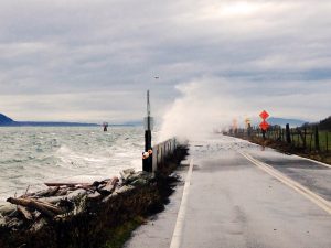
In the late 1970s, conflicts between oceangoing tugs and commercial crabbers became a major problem in Washington, Oregon and California. Crab pots fouled tugs as they moved between coastal ports, and the loss of gear created severe hardships for commercial crabbers. Sea Grant programs on the West Coast helped broker an agreement that provided navigable towboat and barge lanes through the crabbing grounds between Cape Flattery, Washington, and San Francisco.

Since the late 1990s, WSG has led this process, maintaining the industries’ cooperation and saving them more than $1 million annually. WSG will continue to hold several negotiations each year, improve electronic towlane charts and evaluate the project’s economic impacts.

Towards that, in summer 2016 a new set of visually enhanced charts (“chartlets”) was published, and a Google map webpage that will reflect the same detail as the chartlets is currently under development. In addition, WSG is facilitating discussions between industry and the National Weather Service and U.S. Coast Guard to improve marine weather forecasting and coastal bar-closure policies, and will highlight discussion outcomes.


Economic Tools for Resilience in Southwest Washington

Kevin Decker, Coastal Economist

Pacific and Grays Harbor counties, along the Washington Coast, have historically depended heavily upon natural resources for economic health, as they are vulnerable to coastal changes and resources to support coastal resilience and economic health are much needed. Such resources support nearly 100,000 residents working in fishing, timber and service industries. In order to weather changes in a fluctuating economy—including the loss of working-age residents and a decline in higher-paying, non-service jobs—these communities seek to build economic, community and physical resilience.

Washington Sea Grant provided coastal jurisdictions valuable strategic guidance, addressing concerns on economic issues and creating a blog site for go-to economic information. WSG developed an economic dashboard for assessing and interpreting existing data for the region—providing coastal resilience and economic health support informative to economic development planning and decision-making.

Marine Spatial Planning for Washington’s Pacific Coast

Bridget Trosin, Coastal Policy Specialist; Kevin Decker, Coastal Economist; Melissa Poe, Social Scientist


Increased activities in marine waters create potential conflict and competition between uses, from shipping and fisheries to sediment management and renewable energy development. Marine spatial plans (MSPs) grounded in strong public participation and science-based decision making can be important tools for balancing these interests, preserving existing sustainable uses and maintaining ocean health. WSG is part of the state team charged by the Washington Legislature with developing an MSP for Washington’s Pacific coast.


WSG’s role is to help coastal communities understand marine spatial planning and facilitate information sharing between state planners, federal partners, tribes, local marine resource committees and other stakeholders. Staff conduct public outreach, facilitate planning meetings and workshops and coordinate the project’s independent scientific review.


New modeling tool shows impacts of sea level rise, coastal flooding to Whatcom County

February 27, 2024

Created by the United States Geological Survey (USGS) and supported by Washington Sea Grant, the Coastal Storm Modeling System (CoSMoS) will soon be available for use across Washington state

From rising seas to eroding shorelines and more frequent, intense storms, the hazards faced by coastal communities are only projected to grow. Recognizing these threats, planners and managers around Washington are assessing the vulnerability of their communities and planning for impacts – in particular, the impacts of coastal flooding due to storms, sea level rise, and river flooding. But planning for coastal flooding can be difficult when so many different, compounding factors affect where water flows and how high it gets.   

Courtesy of Washington Sea Grant. Photo by Pete Granger.

The Coastal Storm Modeling System (CoSMoS), now expanded to include Puget Sound, is one tool that can help. CoSMoS is a numerical modeling system uniquely capable of interpreting the physics of compound flooding – coastal storms, sea level rise, and river flooding – down to the local scale. As a result, planners, managers and residents can use the new system to help them understand the impacts of coastal flooding to county property, homes and businesses. Whatcom County is the first in Washington state to receive specific projections and results from the tool. And while Whatcom County results were published first, location-specific CoSMoS data will soon be available statewide.   

Puget Sound comprises 2,600 miles of coastline – home to diverse communities, important infrastructure and industry, and habitat critical for commercial fisheries, Tribal Treaty Rights and public well-being. Much of this coastline is at risk of flooding due to the combination of sea level rise, storms, tides and overflowing rivers. Yet whether it lies within a river floodplain or holds important municipal infrastructure, each piece of shoreline has unique and valuable traits that flooding can impact in different ways. CoSMoS has several key features that make it especially useful for examining potential impacts to Puget Sound. First, the system incorporates wind, atmospheric pressure, and sea surface temperature data from global climate models. It then combines these data with models of local water levels that include factors like tides and storm surge. Finally, CoSMoS incorporates a wide range of sea level rise scenarios, allowing planners to view potential flooding impacts in both the near and long term.      

“The model couples together a lot of different coastal impacts. It’s not just sea level rise data, just wave data, just storm data – it’s all of those things together, and all of those things can be factors in the flooding that people experience,” says Sydney Fishman, coastal management specialist at Washington Sea Grant. “The fact that CoSMoS can model all of these factors, that makes it especially important for our geography.”

Predicting local flooding impacts with this level of precision has many uses, especially to local planners. Whatcom County already experiences periodic flooding and storm damage, in particular on the coast and around the lower Nooksack River. The county is actively planning for future higher water levels, more intense storms, and the flooding they bring. Data such as those from the CoSMoS project help planners determine which assets – from roads to ports and parks – are most at risk, and which are most in need of protection. CoSMoS has even been combined with other information to show local socioeconomic impacts from different flooding events. With information in hand, planners can begin to determine which mitigation and adaptation strategies will work best to protect their particular communities. 

Plugging the data now available for Whatcom County into USGS’s Hazard Exposure Reporting and Analytics (HERA) web tool allows a user to define a flooding scenario and see the impacts on particular assets in the county. For example, a user can see how many miles of road would likely be flooded in a scenario of 1.6 feet of sea level rise plus a 100-year coastal storm (defined as a storm with 1% chance of occurring in any given year). The user could even specify roads by type, such as highways, surface streets, or secondary streets.

“CoSMoS has been an invaluable resource,” notes Chris Elder, Senior Watershed Planner at Whatcom County. “It provides local governments like Whatcom County with the ability to not only have a better understanding of storm surge extent and depth, but also to understand inundation and storm surge impacts under projected future sea levels. Access to this data has allowed Whatcom County and partner agencies and governments to assess vulnerability along our marine shorelines and to inform development of necessary adaptation actions.”

Products are available to view in the USGS HERA web tool (usgs.gov/apps/hera) and for download of geospatial hazard data go to:

Grossman, E.E., vanArendonk, N.R., Crosby, S.C., Tehranirad, B., Nederhoff, K., Parker, K.A., Barnard, P.L., Erikson, L.H., Danielson, J.J. 2024. Coastal hazards assessment associated with sea level rise and storms along the Whatcom County, Northwest Washington State coast, U.S. Geological Survey data release, https://doi.org/10.5066/P9I08NS5.

More information is available at the Washington Coastal Hazards Resilience Network: https://wacoastalnetwork.com/project-support/mappers-and-visualizations/cosmos/

Media Contacts:

Chandler Countryman, resilience and adaptation specialist, Washington Sea Grant: ccount@uw.edu; T 206.543.7347

Sydney Fishman, coastal management specialist, Washington Sea Grant: sfishma@uw.edu; T 206.543.5051

###

Washington Sea Grant, based at the University of Washington, helps people and marine life thrive through research, technical expertise and education supporting the responsible use and conservation of coastal ecosystems. The National Sea Grant College Program is part of the National Oceanic and Atmospheric Administration, U.S. Department of Commerce.

www.wsg.uw.edu.

Join the conversation: instagram.com/waseagrant and Facebook.com/WaSeaGrant.

Reflections from the Shoalwater Bay Indian Tribe Partnership Gathering

February 15, 2024

By Chandler Countryman, Washington Sea Grant Resilience and Adaptation Specialist

Last week, Washington Sea Grant took part in the Shoalwater Bay Indian Tribe Partnership Gathering presented by the Office of Secretary, U.S. Department of Transportation, Thriving Communities and Main Street America.

The Shoalwater Bay Indian Tribe’s Tsunami Vertical Evacuation Tower

More than 50 participants gathered in Tokeland, Washington to gain a deeper understanding of the Shoalwater Bay Indian Tribe’s upland relocation efforts. The Tribe has done a tremendous amount of work since 2009 to relocate their community away from the low-lying coastal shores (a location that the Tribe is deeply connected to and has historically called home) due to ongoing challenges related to coastal hazards, especially intense coastal erosion and coastal storms. The area is losing 100-124 feet of land per year – the fastest rate of erosion on the West Coast, and a rate that has already led to the loss of many locally important assets including but not limited to more than 50 homes, a cemetery, a lighthouse, a clam cannery, and about 2 miles of land. It is estimated that with 2 feet of sea level rise – the amount the National Oceanic and Atmospheric Administration projects to happen by the end of this century – Tokeland will be entirely underwater. Unsurprisingly, one of the major beaches in the area is called Washaway Beach.

Views of the Pacific Ocean from the Shoalwater Bay Indian Tribe’s Evacuation Multipurpose Building

The relocation and expansion of the Tribe’s community up the hill and out of harm’s way is a massive undertaking that requires the participation of many federal, state, and local partners to work alongside the Tribe to get it done. These partners came together last week to hear from the Tribe about their various climate resilience efforts, identify gaps in support around their upland expansion project, and map out how partners can best assist the Tribe as they move forward with this work. Partners hopped in vans and on ATVs to tour the upland expansion area, the Tsunami Vertical Evacuation Tower, housing development sites, an evacuation multipurpose building, oyster operations, the tribal museum, and the Army Corps of Engineers berm that is currently protecting much of the shoreline. These were wonderful examples of ways that the Shoalwater Bay Indian Tribe has adapted to change throughout time, reflecting their incredible ability to endure and highlighting their aptitude for resilience.

Over this three day gathering, the Tribe and partners shared many delicious meals together and even more valuable conversations around current and future collaborations, resulting in partnership mapping and action-oriented planning. This event was incredibly special as it is rare to have so many partnering entities at the table simultaneously. We were so happy and grateful to be a part of these conversations and to have been invited by the Shoalwater Bay Indian Tribe. 

###

Washington Sea Grant, based at the University of Washington, helps people and marine life thrive through research, technical expertise and education supporting the responsible use and conservation of coastal ecosystems. The National Sea Grant College Program is part of the National Oceanic and Atmospheric Administration, U.S. Department of Commerce.

www.wsg.uw.edu.

Join the conversation: instagram.com/waseagrant and Facebook.com/WaSeaGrant.


Sociocultural Indicator Assessments and Wellbeing

Melissa Poe, Social Scientist

Integrated ecosystem assessments (IEAs) are important tools for ocean and coastal policy making. To foster a better understanding of the social dimensions of marine and coast environments, WSG is working jointly with the Northwest Fisheries Science Center and UW School of Marine and Environmental Affairs to develop indicators of human wellbeing.

Social indicators provide important information on the status of and trends in human wellbeing. As part of the IEAs, social indicators also help decision makers better anticipate outcomes from policy and other social changes, and from ecosystem changes along Puget Sound and the West Coast.


Training and Professional Development for Shoreline and Coastal Planners

Nicole Faghin, Coastal Management Specialistt


Communities, nongovernmental organizations and coastal businesses in Western Washington need information to help them prepare for future coastal issues. WSG meets this need by providing training, outreach, networking opportunities and technical assistance to shoreline and coastal planners. Working with the Washington Department of Ecology (Ecology), WSG established and will continue to support the Shoreline and Coastal Planners Group (SCPG), providing regular opportunities for coastal professionals to discuss policy concerns, new technologies, emerging issues and other relevant topics.

More information is available here:


WSG maintains the SCPG email list and website, coordinates regular group meetings, facilitates new partnerships and provides a network for exchanging technical information. WSG also coordinates and presents a broad range of full-day training sessions for professionals working with Ecology’s Coastal Training Program.

Examples of past training topics include:

  • “How to Administer Development Permits in Western Washington’s Shorelines,”
  • “Presentation Skills for Scientists and Public Officials,” and
  • “Climate Change Series.”


Contact Nicole Faghin at faghin@uw.edu.

Washington Sea Grant receives federal funding to advance resilience in coastal and fishing communities

January 10, 2024

Washington Sea Grant (WSG) is pleased to receive federal funds through NOAA Sea Grant in support of its work to advance resilience in coastal and fishing communities throughout Washington state. 

The WSG project seeks to enhance Washington coastal resilience in several ways. These include but are not limited to: broadening outreach to coastal communities on coast-specific climate hazards; connecting marine and coastal resource managers with funding opportunities to address coastal hazards; communicating hazard risk reduction and resilience best practices to coastal stakeholders; and increasing capacity for shoreline erosion monitoring and analysis.    

Coastal communities face a variety of challenges, from increased flooding and erosion to more intense storm surges and wind damage as a result of climate change and sea level rise. Recognizing these challenges, the project builds on WSG’s decadeslong efforts to deeply and sustainably engage and promote the resilience of Washington’s coast. Initiatives such as the WSG-led Washington Coastal Resilience Project have focused on increasing local access to sea level rise information and planning capacity, as well as capital investment in coastal restoration and infrastructure. WSG has also supported the ongoing development and rollout of the Coastal Storm Modeling System (CoSMoS) to help coastal planners and decision-makers understand their communities’ flood risks. These and similar efforts are all the more important given the threats posed by ocean and climate change are only projected to grow.

The WSG project also aims to promote resilience in Washington state fisheries. In particular, the project will leverage new funding to hire a new fisheries specialist, expanding staff capacity beyond Seattle and the Pacific Coast to northern Puget Sound. Other activities will include providing new trainings to help build a skilled fishing labor force; expanding or reviving trainings on sea safety and survival, first aid at sea, reading and responding to marine weather, and servicing and maintaining diesel engines; and continuing to support the direct marketing and sale of seafood from fishers to consumers. New funds will also help WSG support the Makah Tribe’s Food Sovereignty Program through increasing seafood access and distribution.     

This project is made possible through NOAA Sea Grant Coastal Adaptation and Resilience institutional funding. NOAA Sea Grant awarded a total of $4 million to Sea Grant programs nationwide to further their work or act on new opportunities in the coastal resilience landscape. 

Learn more about the other selected projects here.


###

Washington Sea Grant, based at the University of Washington, helps people and marine life thrive through research, technical expertise and education supporting the responsible use and conservation of coastal ecosystems. The National Sea Grant College Program is part of the National Oceanic and Atmospheric Administration, U.S. Department of Commerce.

www.wsg.uw.edu.

Join the conversation: instagram.com/waseagrant and Facebook.com/WaSeaGrant.


Washington Sea Grant receives new grant to support coastal resilience

February 12, 2024

Washington Sea Grant (WSG) is pleased to announce that it will partner with the Washington state departments of Ecology, Transportation, and Fish and Wildlife to support coastal resilience work as part of a new $850,000 grant. The grant comes from the National Coastal Resilience Fund, a partnership between the National Oceanic and Atmospheric Administration (NOAA) and the National Fish and Wildlife Foundation.

Washington’s 3,300 miles of shoreline along Puget Sound and the Pacific Ocean are home to coastal communities, public infrastructure, and important habitat. In the face of growing coastal hazards like sea level rise, flooding, and erosion, WSG will play a key role in supporting state efforts to protect critical infrastructure, improve community resilience, and advance nature-based solutions.

In particular, the funded project will allow the Washington state Department of Transportation (WSDOT) to update its 2011 climate impacts vulnerability assessment. WSG will provide technical expertise in incorporating new data and tools, including up-to-date local sea level rise projections, into this assessment.

WSG will also join the project team in working with local partners to identify three to six nature-based hazards resilience projects to implement at the community level. WSG will help to develop and implement community and stakeholder workshops toward this goal, as well as serve as a liaison between this project and other sea level rise and climate adaptation projects in Washington state. 

This new funding builds on $74.4 million recently awarded by NOAA to the Washington state Department of Ecology for coastal and climate resilience work in Padilla and Willapa bays, as well as NOAA Sea Grant’s recent investments in WSG-led resilience work in coastal and fishing communities, part of $4 million distributed nationwide.    

###

Washington Sea Grant, based at the University of Washington, helps people and marine life thrive through research, technical expertise and education supporting the responsible use and conservation of coastal ecosystems. The National Sea Grant College Program is part of the National Oceanic and Atmospheric Administration, U.S. Department of Commerce.

www.wsg.uw.edu.

Join the conversation: instagram.com/waseagrant and Facebook.com/WaSeaGrant.


Washington Sea Grant welcomes first Economic Recovery Corps fellow

February 20, 2024

Washington Sea Grant (WSG) is excited to welcome Jessika Tantisook as its first Economic Recovery Corps fellow. The inaugural cohort of the Economic Recovery Corps (ERC) will spend the next 2.5 years enhancing the economic development efforts of host organizations like WSG around the United States.

Jessika’s work, in particular, will cover several focus areas on the southwest Washington coast. Long reliant on ocean-based livelihoods like fishing, boating, and the industries they support, these communities face growing challenges, from changing weather patterns to an aging marine workforce. Amidst these complexities, the Coastal Opportunities for Resilience and Livelihoods (CORaL) project honors the desire of Washington’s rural coastal communities to maintain a strong marine-based economy. Initiatives under the CORaL project include the creation of a new business incubator and marine trade center; increased marine trade training efforts; marine economic visioning; and the development of tribal shellfish aquaculture. Jessika will be responsible for stakeholder engagement and facilitating communication across partners and regions, helping to create a comprehensive vision of a resilient and robust ocean economy across the Washington coast.

Jessika has lived and worked in economic development on Washington’s coast for over a decade. As a coastal community leader and local food systems aficionado, she has experience starting and operating an organic food processing business, building a regional food hub, and developing equity-focused programming to support small businesses. Most recently, she spent five years as the Executive Director of the nonprofit North Coast Food Web, leading the creation of its first strategic plan and helping to grow its food hub operations into a pillar of the Columbia-Pacific region’s local food economy.

“As a decade-long coastal community member, I’m looking forward to adding much needed capacity to key projects in our region,” Jessika notes. “I’m excited to meet and learn from the Washington Sea Grant team, and to share all the great things we’re doing locally with my national cohort of fellows.”

The ERC Fellowship program aims to build capacity in economically distressed areas across the U.S. while cultivating the next generation of economic development leaders. The program connects 65 host sites nationwide with diverse practitioners and leaders with the passion, skills, and vision to create new ways of doing economic development. The ERC Fellowship was launched in 2023 through a $30 million cooperative agreement with the U.S. Department of Commerce’s Economic Development Administration. It is led by the International Economic Development Council and supported by 6 other national economic development organizations.

Learn more about the ERC here, and about Jessika’s project here.

###

Washington Sea Grant, based at the University of Washington, helps people and marine life thrive through research, technical expertise and education supporting the responsible use and conservation of coastal ecosystems. The National Sea Grant College Program is part of the National Oceanic and Atmospheric Administration, U.S. Department of Commerce.

www.wsg.uw.edu.

Join the conversation: instagram.com/waseagrant and Facebook.com/WaSeaGrant.

Whatcom Watersheds Information Network

Sue Blake, Water Resource Educator

The Whatcom Watersheds Information Network (WWIN) is a network of representatives from government agencies, non-profit organizations, educational institutions and citizens who are involved and interested in marine and freshwater ecosystems and natural resources education and outreach.
WSG educator Sue Blake coordinates and supports WWIN activities. The primary mission of the network is to support and improve watershed education, stewardship, information exchange and public involvement in Whatcom County.


Working Waterfronts and Waterways

Nicole Faghin, Coastal Management Specialist

Working waterfronts contribute to local economies and enrich Washington’s cultural and social heritage. But shoreline-dependent industries, government agencies, native tribes and the public struggle to gain access to shorelines, waterways and waterfronts. The past decade has brought notable, accelerating conversion of valuable waterfront real estate, with negative socioeconomic and environmental effects. WSG works with stakeholders in Washington and across the nation along with other Sea Grant programs to promote the best uses of working waterfronts.
WSG is a member of the National Working Waterfront Network and works with the Washington Public Ports Association and other community-based maritime efforts to develop and maintain a Washington network. WSG actively supports efforts to strengthen maritime workforce capacity in the state working collaboratively with a coalition of public and private maritime education and training providers and industry representatives.

WSG hosted the 2013 National Working Waterfronts and Waterways Symposium in Tacoma and the Coastal Management Specialist was a member of the steering committee for the 2015 symposium.