At Indian Island Lagoon, Crab Team monitors will be retiring their measuring rope and quadrat, two tools of the transect trade. Photo courtesy of Kathleen Waldron
April 1, 2025
Today is the first day of the 2025 monitoring season and the Crab Team monitoring network is undergoing one of our biggest changes of the last decade. It is with very considered deliberation, discussion, and debate that we have decided to sunset the shoreline transect survey, one of the three sampling protocols that has been a part of the routine at Salish Sea Crab Team sites for nearly a decade.
Long time Crab Team participants know that the monitoring network places a very heavy emphasis on consistency – making sure sampling efforts yield data that can be compared across all sites, all six sampling months per year and over the course of the 10 years of the program – so far! That continuity is no small feat for a program of this size and particularly benefits from long-time participation of individual monitors and staff, as well as continued on-the-ground engagement by staff and annual refresher training for monitors. But comparability over space and time is key to the value of the long term ecological monitoring dataset the program has built, to ensure that all of the data collected by the more than 700 community members and biologists can be trusted by researchers and managers who use it to learn about the green crab invasion and the pocket estuary habitats of Washington.
So why now?
The transect protocol was carefully designed to track features of the Salish Sea shoreline that could be evaluated relative to potential impacts of green crabs as they invaded and associations with habitat features that might mark more favorable conditions for green crab survival. The most recent iteration of the protocol was actually our second, as the pilot year protocol used in 2015 needed some adjustment to be more tractable across the broad range of habitat features encountered at sites within the network. That said, none of the sites along Washington’s inland shorelines yet have large enough densities of green crabs that we would expect changes to be detectable in these dynamic habitats (thankfully!).
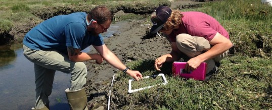
Crab Team at Blakely Harbor carefully considers shoreline cover categories as part of the transect survey. Group members were encouraged to discuss cover estimates and examine the quadrats closely. Photo courtesy of Bob Rosenbladt
As Crab Team rounds a decade, we can reflect that we have achieved a solid baseline dataset for the shoreline transect. Salish Sea sites have up to nine years of monthly observations of wrack, vegetation, and epifauna comprising the transition zone between intertidal and emergent terrestrial habitat structure – a zone that is likely to be highly impacted by green crabs where they become abundant. This period even included a significant rare disturbance event, the 2021 “Heat Dome,” which scientists are still learning about (for more, read recent research by Miner et al., Raymond et al., and a forthcoming paper from Crab Team!).
Even this rooted vegetation couldn’t “stump” program lead, Emily Grason, though Crab Team staff were sometimes called out into the field to interpret how to record “edge cases” like this one. Photo courtesy of Kathleen Waldron
The length and resolution of the sampling to now helps us see how much “natural” variation we might expect, and what trends in seasonal timing we typically see, in the absence of significant green crab influence. This way, if/when green crabs do become abundant, we can distinguish a signal of green crab from the noise of variability due to other factors.
The second factor to the decision to sunset this protocol is that we feel that as a program staff, we want to make sure that we only ask monitors to collect data that we ourselves can demonstrate the use of. As the green crab issue has grown in Washington State, Crab Team has also grown substantially, but so have the management needs of the state. So the staff of Crab Team have less capacity than they would want to ensure the protocol remains reliable and the data collected are undergoing analysis and investigation on a continual basis. As we work to support tribes, managers, and trapping partners across the state, finding time to do this has become increasingly tricky.
Nevertheless, the shoreline data documented to date, every single quadrat, will be well stewarded by Crab Team, both internally in our database and archives, as well as externally as we publish the dataset. Thus this baseline will remain a very high resolution snapshot against which future changes could be compared.
That’s a lot of variability! This figure compiles all of the data collected on rooted vegetation during the shoreline transect survey, showing seasonal and annual trends in the monthly average by site (to find the site location, search for the site number, which at the top of each panel, on the Crab Team site map or Tableau dashboards). Click figure to enlarge
What does this mean for monitors?
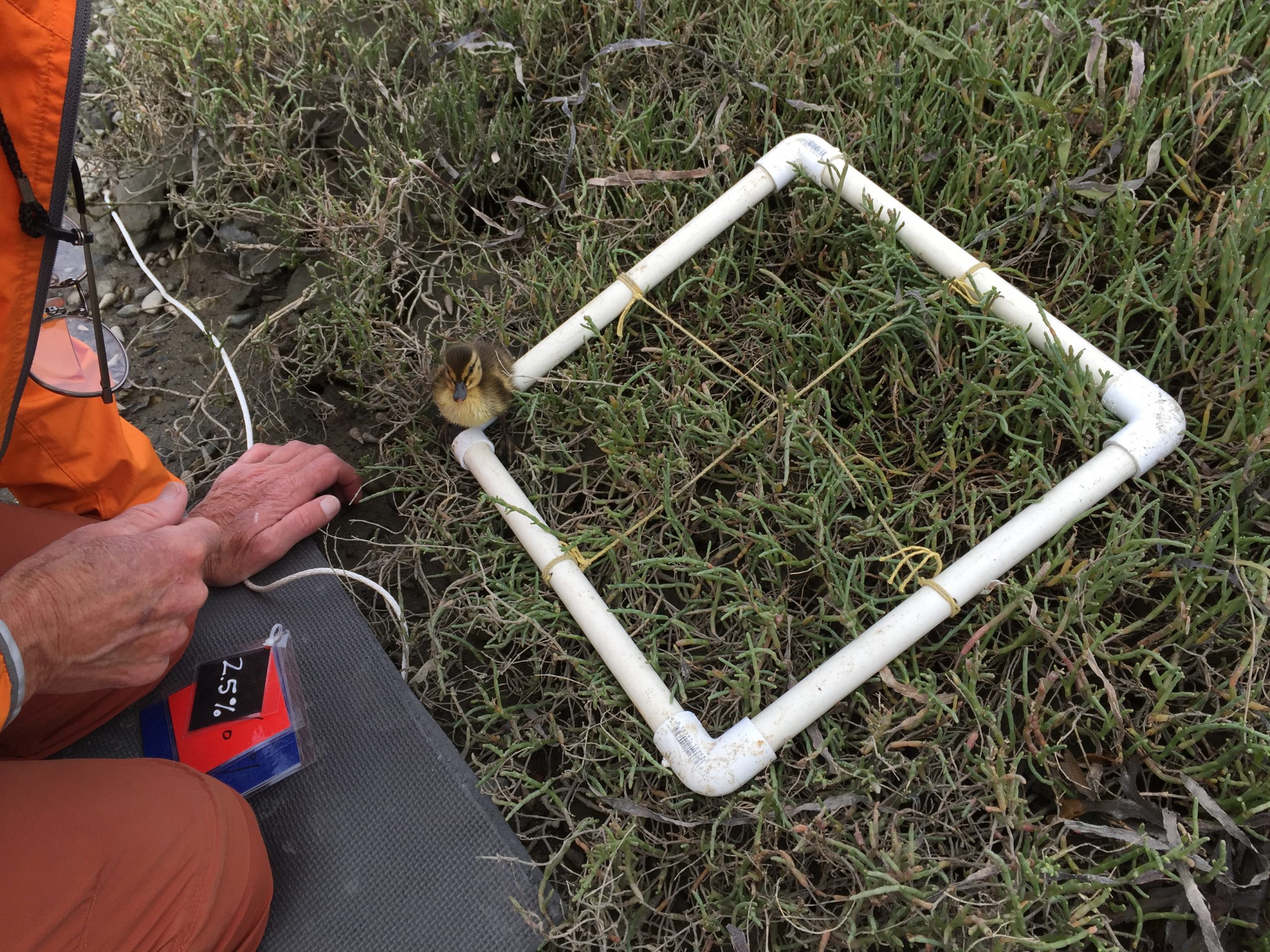
Does a duckling count as live epifauna? The Crab Team rule of thumb is if it can walk out of the quadrat faster than you can record its percent cover, it doesn’t count for the survey! Monitors at Post Point will miss their chance to meet the local pocket estuary fauna encountered during their transect surveys. Photo courtesy of Bob Cecile. Click to enlarge
At the most basic level, this means that monitors at Salish Sea sites will have one less survey to conduct and one less data sheet to submit each month. In addition, over the course of 2025 refresher training workshops this past month, we have been reflecting with continuing monitors on some of the less tangible impacts that might come from this change. In introducing this change to monitors who have been working on this survey for up to nine years, groups expressed a range of reactions, from gasps to groans, cheers and, yes, even some disappointment, too!
Some monitors have described how estimating the wrack, vegetation, live epifauna and substratum repeatedly over 10 quadrats per month, and six months per year was a chance to get more intimately familiar with the small features of the shorelines they love – like the tiny flowers on pickleweed, and the red velvet mites. They worry they will miss this close connection with their site. Other monitors have been thinking about how this change could alter group dynamics at the site, as negotiations over cover estimates offered a rich opportunity to get to know teammates. Crab Team staff have also reflected that monitors could start moving around sites differently, as up to now we emphasized avoiding walking in “the data zone” to avoid altering the data through trampling. While data are at the core of Crab Team, we know the experience of being a Crab Teamer is about much more than data alone. The great thing about having such a large and committed team is that we will all be experiencing and reflecting on this change together.
–Emily Grason
APR
2025