March 6, 2023
The two WSG-led projects selected for funding will focus on sea level rise vulnerability and managing invasive European green crab
Two projects led by Washington Sea Grant (WSG) will receive a total of $1.59 million through the Puget Sound National Estuary Program’s Habitat Strategic Initiative, a partnership between Washington Department of Fish and Wildlife and Washington Department of Natural Resources. The WSG-led projects will focus on sea level rise vulnerability ...
Read More
6
MAR
MAR
0
 As sea levels continue to rise, coastal hazards such as flooding and erosion will become increasingly common. According to recent assessments, over 14,000 homes and structures in Washington State — representing a current value of over 8 billion dollars ...
 We were deeply saddened to learn of the death of Crystal Dingler, who was mayor of Ocean Shores, Washington. Dingler partnered with Washington Sea Grant on many projects, especially on initiatives geared toward building greater economic resilience in Grays Harbor County.
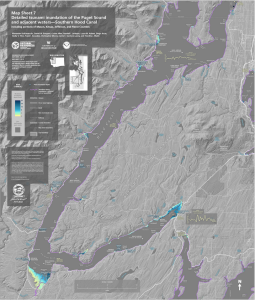 It’s not a matter of if, but when. New tsunami hazard maps published by the Washington Geological Survey and the Washington State Department of Natural Resources (DNR) show that a large earthquake on the Cascadia subduction zone (CSZ) off ...